Photo Gallery.
Out and about in Amble, Northumberland and surrounding villages, coast
and river. Photos of anything and everything!
|
 |
 |
 |
 |
|
Bricks & Brickworks (sub-gallery) |
Wrecks on the mudflats of the Coquet estuary. (sub-gallery) |
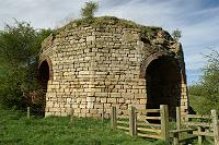
Shilbottle Lime Kiln
(sub-gallery) |
Coquet Island
(sub-gallery) |
|
|
|
|
|
 |
 |
 |
 |
Amble Inshore Lifeboat
rescues the Pizza Man |
The late lamented Freddie the
dolphin |
Amble Greasy Pole (70s?) |
An old bell pit at Amble,
possibly working the Northumberland Low Main ( aka Brass Thill )
or the Plessey seam which are close to the surface here. |
 |
 |
 |
 |
|
Amble 7th Sept 2010 2.45pm - half an hour before high tide
(5.1m). Large wave striking the South Breakwater producing a 50
foot upward jet. (note the audience on the pier to the left) |
Now you see me.....now you don't. No one fishing from the end
of the South Pier today?....... |
Warkworth |
Warkworth Hermitage (part of) |
|
|
|
|
|
 |
 |
 |
 |
| Abigail H dredging at Amble 2007.
This vessel sank in Heysham Harbour not long after this. |
Both piers at Amble and Coquet Island, same shot. |
2010 Red Row Vintage Rally, Druridge Bay
Country Park (sub-gallery) |
Hauxley Chapel |
| |
|
|
|
 |
 |
 |
 |
| |
|
Warkworth Harbour: |
| Hauxley Nature Reserve |
Low Hauxley |
The rather infamous
end of the North pier which failed structurally many decades
ago. The original plinth of the north light remains, the light
itself being moved a few yards landwards onto a new firmer
footing |
| |
|
|
|
 |
 |
 |
 |
| Warkworth Harbour: |
| The North pier, view from the end looking
landward. Photographed on a cool autumn day. Warkworth castle
extreme right. The reinforcements on the north side, consisting
of many thousands of tonnes of dolerite (whin sill) blocks were
added in 1984. |
The Braid from Gloster Hill with the harbour
beyond, photographed about 1982. No Marina yet, construction of
which began in 1986. |
Disused North Jetty at low tide. |
South Breakwater, 2.30pm, 6th Sept 2010.
High tide (4.9 m), south easterly,
winds 30 mph with 50mph gusts.
|
| |
|
|
|
 |
 |
 |
 |
| The South Breakwater, looking towards the
South Pier end. Many vessels have come to grief on this small
area of rocks. (see the
shipping losses page) |
Cliff House, originally built for the project
manager during the construction of the harbour, later becoming
the coast guard station, now a private residence. Piers in the
distance. |
Fishing boat race (2003) |
Fishing boat race, competitors round the
North Breakwater (2003) |
| |
|
|
|
 |
 |
 |
 |
| The old course of the river Coquet
photographed from Amble; Warkworth golf course in the middle
distance, which is close to where the river originally entered
the sea (through the dunes on the left). This old course still
partially fills at high tide. Alnmouth in the distance. |
Abandoned and for sale: Castle Service
Station on the Warkworth road. (2003) now demolished and a row
of houses stands here. |
Kayaking within the safety
of the south breakwater |
Nimrod fishing boat |
| |
|
|
|
 |
 |
 |
 |
| Provider fishing boat |
Northumberland miner's
Safety badge and union badge. |
The Turner Street Cinema, Amble, 1995. Closed
as a cinema in the 60s, but used as a bingo hall 70s and 80s.
Now demolished and currently a parking area. |
Another view of the Cinema |
| |
|
|
|
 |
 |
 |
 |
| River Coquet & Warkworth Castle |
The Dock Public House, Queen Street, Amble. |
The Waterloo Public House, Queen Street,
Amble. |
The Blue Bell Public House, Albert Street,
Amble |
| |
|
|
|
 |
|
 |
 |
| Royal British Legion Club (boarded up
building on the right) - the war memorial clock is off image to
the left. The club was demolished and this area remodelled into
the Town Square. |
|
Druridge Hamlet |
Bondicar Point just south of Low Hauxley.
This area is a geological SSSI due to the superior exposure of
Quaternary glacial tills, peat and blown sand. (Coquet Island to
the right.) |
| |
|
|
|
 |
 |
 |
 |
| WW2 defensive emplacement or
"Pill Box", Druridge Bay. |
Sea angling from Hauxley beach
into the Coquet Roads. Last hour of daylight on a winter's day. |
| 5.9 metres width and 4.7 metres max depth
from rear doorway to front face. The concrete is 0.38 metres
thick. |
Buried almost up to the apertures. The whole
structure has also rotated down towards the sea. |
Overall shape is an irregular hexagon with
doorway attached to the rear. |
| |
|
|
|
 |
 |
 |
 |
Interesting dune beast?
A fine looking Chibburn bull calf.
Some of the back dunes at Druridge Bay are used for cattle. |
Holocene Woods.
Amble's ancient forest: Intertidal peat with branches, trunks
and roots. 5500 years BC. |
Line of WW2 'anti-invasion' concrete block
beach obstacles at Druridge Bay. Found in two sizes, 4 foot
cubes and 5 foot cubes. this is a line of the 4 foot type |
More beach obstacles, this time located to
the immediate south of the river Aln (near Church Hill) These
have been cast around a 1" diameter steel rope |
| |
|
|
|
 |
 |
 |
 |
| Inspecting a pill box on top of Church Hill,
Alnmouth. This one is almost completely buried. Although we did
not measure this structure, size and design look exactly the
same as the Druridge Bay pill box pictured above. |
The Victorian mortuary chapel at the south
west side of Church Hill, Alnmouth. |
Another view of the Church Hill mortuary
chapel. The roof was deliberately removed by the National Trust
to deter squatters. |
Church Hill mortuary chapel doorway, a
Victorian building but the doorway finished in an interesting
Norman style. |
| |
|
|
|
 |
 |
 |
 |
| A view south across the whole of Druridge
Bay. Water from the Bondicar burn in the foreground, Rio Tinto
Alcan power station (left) and the Lynemouth Aluminium smelter
in the distance. |
Low Hauxley |
View from Gloster Hill to Warkworth across
waterlogged and frozen fields. New Year's Day 2010 |
Gloster Hill, New Year's Day 2010 |
| |
|
|
|
 |
 |
 |
 |
| Christ Church North Broomhill |
The Trap Inn North Broomhill |
Morwick mill race inlet/upstream. |
What remains of Morwick mill
weir across the Coquet. |
| |
|
|
|
 |
 |
 |
 |
| Morwick mill race terraced stonework. |
Helsay |
Morwick Water Tower.
Built in 1963.Constructed from reinforced
concrete, the Service Reservoir supplies the areas of Morwick,
Acklington,
Amble, North Togston, Togston, Broomhill, High Hauxley, Hadston
& Widdrington. Capacity: 568m3, depth: 5.49m, normal throughput
200m3 per day. Average storage 68 hours
N |
Broomhill Water Tower/Service Reservoir,
built 1955, abandoned in the 1980's. (also see
photo
in the old images gallery) |
| |
|
|
|
 |
 |
 |
 |
| East Cemetery Chapel Spire, Amble |
Amble Harbour Office |
Redundant mooring bollard, Warkworth Harbour,
Amble. From a bygone era when the vessels using the port were an
order of magnitude larger than those of today. |
New use as traffic bollards.
....how sad....
If they could talk what stories they could tell... |
| |
|
|
|
 |
 |
 |
 |
| Delaminating weathered sandstone in the
cliffs at Wellhaugh Point, Amble |
Salt Pans, Cliff House and Piers, Amble. |
Cast Iron Warkworth Harbour Boundary Markers.
'W.H.C' = 'Warkworth Harbour Commissioners'. Three left; these
are now listed and protected, but can you find them?? |
The Hermitage Inn Warkworth |
| |
|
|
|
 |
 |
 |
 |
| Warkworth Castle overlooking 'Mill walk' and
the Coquet. Rowing boats for hire on the bank. |
Crossing point and ferry boat for
Warkworth Hermitage |
Warkworth Market Cross |
The Old Warkworth Bridge |
| |
|
|
|
 |
 |
 |
 |
| Warkworth River rowing boats for hire |
'Amble' sign, Warkworth road. |
Hauxley Hall |
New Hall Farm Amble |
| |
|
|
|
 |
 |
 |
 |
 |
| Big swings |
Aerial slide |
|
| Cavil Head, Acklington, now known
as "Warkworth Farm Shop". Tea rooms, farm shop and a large kids
play area. (Recently converted from derelict farm buildings with
a 'One North East' rural development grant.) |
| |
|
|
|